LAKE MANYARA
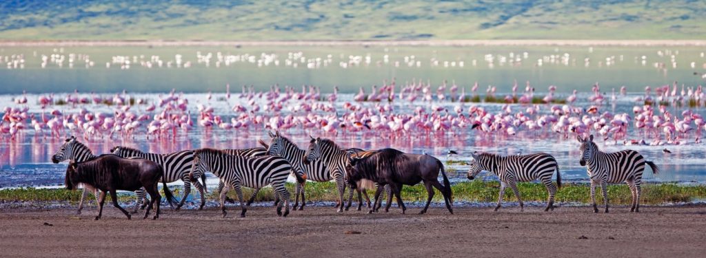
Lake Manyara is an alkaline water lake located in northern Tanzania, 100 km southwest of Arusha, at the foot of the western Escarpment of the Great Rift Valley. It is about 50 km long and 16 km wide, with a total area of about 230 km². The lake and part of the surrounding area form the protected natural area of Lake Manyara National Park. The name “Manyara” comes from the word maasai emanyara, which indicates a species of euphorbia, the Euphorbia tirucalli, which is used in the area as a hedge to delimit livestock enclosures. The lake is located near the village of Mto wa Mbu (in Swahili language it means “river of mosquitoes”), where there is a local market and that collects many ethnic groups: Mgubwe, Iraqw, Gorowa, Irangi, Tatoga and Masai[without source]. It is perhaps the only place in Africa where you can hear languages from all four major African language families: Bantu, Khoisan, Cuscitiche and Nilotiche. The lake and the surrounding area, included in the national park, constitute an ecosystem renowned for its wealth of plant and animal species. The vegetation is very varied, with areas of primary forest, tunnel forest and savannah, as well as lake vegetation. The fauna includes numerous elephants, baboons, wildebeests, zebras, giraffes, hippos and other species. The abundance of birdlife makes the lake a real paradise for bird watching. Particularly well known are the Manyara lions, which have the habit of climbing trees in this area (a behaviour very rarely observed elsewhere), and the large flocks of pink flamingos. Ernest Hemingway, who described his safari in this area in the novel Green Hills of Africa, called the Manyara “the most beautiful lake in all of Africa”.
ARUSHA NATIONAL PARK
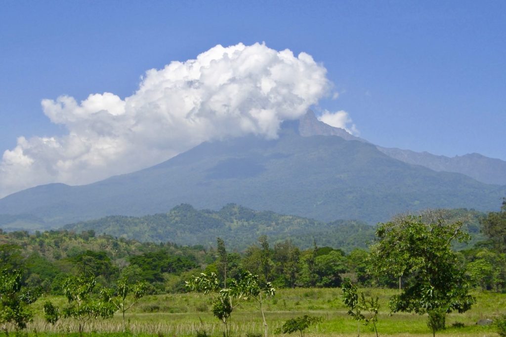
Arusha National Park is a protected natural area in northern Tanzania, located 25 km from the city of Arusha and 35 km from Kilimanjaro Airport. It belongs to a group of parks known as the “Northern Safari Circuit” which also includes the Lake Manyara National Park, the Tarangire National Park, the Serengeti National Park and the Ngorongoro Nature Reserve. The name “Arusha” comes from Warusha, the name of the local population of the region. Many local place names are linked to the tradition of the Masai, another people present in the area. Although it is one of the least extensive parks in Tanzania, with an area of 137 km², the park includes many distinct habitats. Three main areas can be distinguished: the Ngurdoto crater, the Momela (or Momella) lakes and Mount Meru. The slopes of the Ngurdoto are covered by rainforest, while inside the crater there are swamps and savannah areas; on the Meru, at high altitude, there is an alpine type of vegetation. The park’s fauna is equally diverse. The avifauna is represented by over 300 species, some migratory and others sedentary, most of which are concentrated in the area of the Momela lakes, where there are huge colonies of flamingos. The park is also known to have the largest concentration of giraffes in the world. Other animals present are for example hippos, buffaloes, warthogs, numerous species of antelopes, leopards and hyenas. In the park 10 species of amphibians and 24 species of reptiles were surveyed. Walking safaris are possible in some areas of the park (rare in Tanzania).
LAKE EYASI
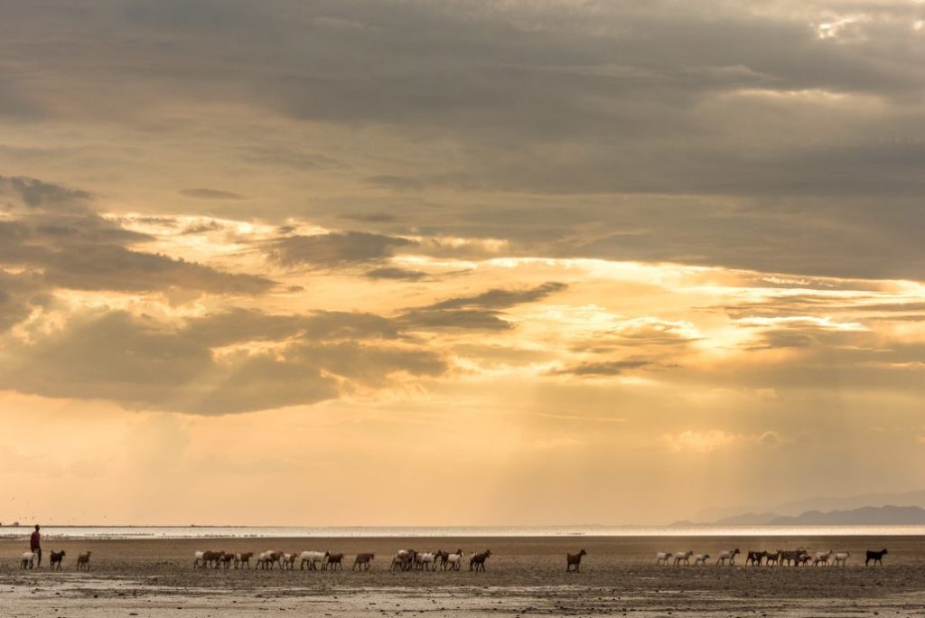
Lake Eyasi, formerly known as Lake Njarasa or Lake Hohenlohe, is a shallow, endoreic salt lake located at the bottom of the Rift Valley just off the Serengeti National Park and just southwest of the Ngorongoro Conservation Area, two of the most beautiful destinations in Tanzania. The lake has an elongated shape and is located in the Eyasi-Wembere branch of the Great Rift Valley. What makes Eyasi Lake famous are mainly two elements: the great animal and plant biodiversity and the presence of two tribes, the Datoga and the Hadzabe, that you can know thanks to our itineraries in Tanzania. During the dry season the lake can dry up almost entirely, especially in the driest years, giving the shepherds Datooga and the foragers of Hadza the opportunity to cross the lake on foot. During El Niño, a climatic phenomenon that causes the warming of the waters of the Pacific Ocean, Lake Eyasi can be flooded and attract hippos from the Serengeti to its shores.
NATRON LAKE
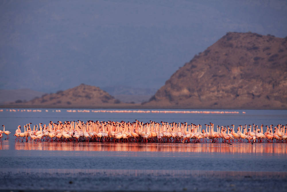
Lake Natron is a salt lake in northern Tanzania located in the African Rift Valley at about 600 meters above sea level, near the Kenyan border. Near its southeast shore is the Gelai Volcano. The lake, which barely reaches a depth of three metres, varies in width depending on the filling level of its reservoir. Its characteristic colour, a deep, dark red with superficial whitish streaks due to the accumulation of sodium, is a common feature of lakes where intense evaporation cycles occur. As the water evaporates during the dry season, the salinity level increases to such an extent that colonies of microorganisms quickly begin to flourish. These microorganisms include cyanobacteria, small bacteria that develop in an aquatic environment by drawing nourishment from sunlight using a procedure similar to the chlorophyll photosynthesis of plants. These bacteria contain the bright red pigment responsible for the colour of Lake Natron, which however takes on tonal variations tending to orange in parts where the water is shallower. In addition to these bacteria, the only living thing that can survive in its waters is the lesser flamingo, thanks to a protective horny layer on its legs and beak: in fact, the water of Lake Natron is not only undrinkable, but also extremely caustic for the skin. This is due to the high content of a natural compound lethal to many animals: sodium carbonate hydrate, known as natron. Used in the past in embalming operations because of its dehydrating properties, natron makes the lake water similar to ammonia, with an extremely basic pH (between 9 and 10. 5), while its temperature can reach prohibitive values (up to 60 °C). No animal can resist in this caustic environment, except various species of algae, extremophilous fish and flamingos, which usually live in the margins of the basin. Contrary to what is thought, the lake has no petrifying properties on living organisms, but simply the lifeless remains of the animals, which have come into contact with water that is strongly alkaline and rich in salts, do not suffer the effect of decomposition, thus being embalmed and made similar to statues.
NGORONGORO
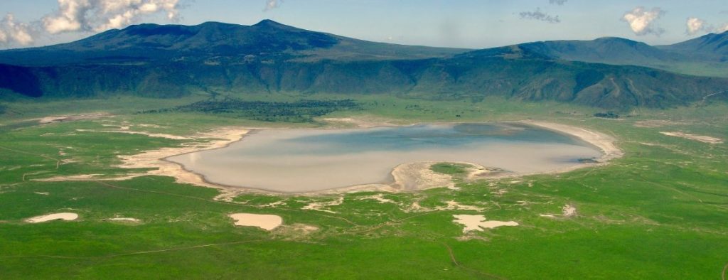
The Ngorongoro Conservation Area is a protected natural area of Tanzania that extends into the area of the Ngorongoro caldera located in the Serengeti plain, northwest of the city of Arusha and east of the Serengeti Park, with which it forms an uninterrupted territory. The area around the crater forms the nature reserve of Ngorongoro. The crater of Ngorongoro is located at 2,200 meters above sea level, measures over 16 kilometers in diameter and occupies a total area of about 265 square kilometers. This is the largest intact caldera in the world. The crater belongs to the largest area (about 8300 square kilometers) of the Ngorongoro Nature Reserve (Ngorongoro Conservation Area, or NCA). The entire NCA area has been declared a UNESCO World Heritage Site. Thanks to the good rainfall, the ponds and small inland lakes and streams, the night fog that surrounds and feeds the forests on the slopes of the old volcano, the area has become a real ecosystem. The savannah occupies the innermost area of the crater, alternating with stretches of swamp, acacia patches and semi-desert arid areas; in the middle of the crater is a lake. In the crater the concentration of fauna is impressive: it is estimated that it is inhabited by over 25000 large animals. The most typical image is probably that of the huge herds of zebras and wildebeests, but the crater is home to most of the typical species of the savannah: elephants, lions (about a hundred, this is the most densely populated population in the whole of Africa), buffaloes, hyenas, jackals, hippos, baboons, cheetahs, as well as some rather rare ones such as the black rhinos, the last survivors of a species that in the rest of Tanzania is on the verge of extinction, and leopards, which live on the trees of the rainforest covering the crater slopes. Countless species of birds are attracted to the reserve, which with its numerous ponds is an attraction for migratory fauna: among them are the flamingos, which are one of the most numerous colonies in Africa. No giraffes and impalas instead. The local Masai tribes have the right to graze in this area and may happen to meet them with their livestock.
SERENGETI
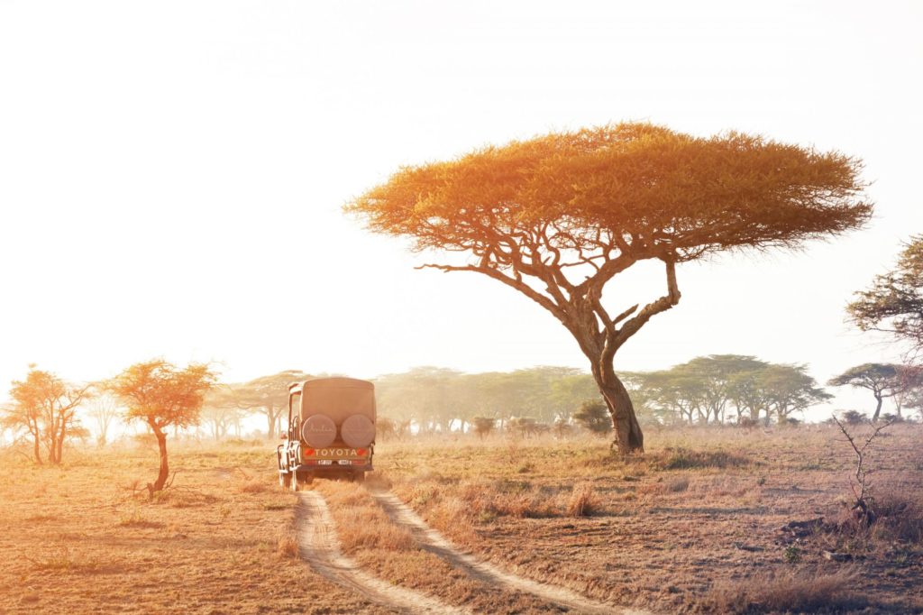
The Serengeti National Park (in English Serengeti National Park, from the language of the local Masai people, “boundless plain”) is one of the most important protected natural areas in East Africa. With an area of 14,763 km², it is located in northern Tanzania, in the homonymous plain, between Lake Victoria and the border with Kenya (1. 30′-3. 20′ S, 34. 00′-35. 15′ E), adjacent to the Kenyan park of Masai Mara, the nature reserve of Ngorongoro and other important wildlife reserves. Declared World Heritage Site by UNESCO in 1981, it is one of the main tourist attractions in Tanzania, and the most important of a system of four protected natural areas, which also includes the Lake Manyara National Park, Tarangire National Park, Arusha National Park and Ngorongoro Nature Reserve. The park initially included the Ngorongoro Crater, which became an independent protected area in 1956. After Tanzania achieved independence, the administration of the park was entrusted to TANAPA (Tanzanian National Parks). In 1981, UNESCO declared the park a World Heritage Site because of its rich biodiversity. It is located in northern Tanzania; its northern border coincides with that between Tanzania and Kenya, and divides it from the Kenyan reserve of the Masai Mara. There are no fences between the two parks, and the fauna moves freely from one to the other; particularly well known are the massive seasonal migrations of wildebeest. Besides the Masai Mara, the Serengeti borders the Ngorongoro reserve to the southeast, the Maswa wildlife reserve to the southwest, the Ikorongo and Grumeti reserves to the west, and the Lalianda reserve to the north. The tropical climate of the area is characterized by two periods of seasonal rains: the “big rains” from April to June and the “small rains” from October to December.
The southern part of the park consists of vast arid grasslands, interrupted by metamorphic rock hills often surrounded by bushes and trees, and known locally as kopjes. These small rock formations surfaced as a result of erosion of the surrounding soil by atmospheric agents. Proceeding northwards, the landscape changes: the increased rainfall, which also feeds some permanent rivers, favours the growth of gallery forests and the formation of areas of wooded savannah (characterized by acacia groves) and thorny bush savannah. The giraffe changes the appearance of the Serengeti: by regularly nibbling the tops of the acacias it gives them the characteristic flat shape. At the beginning of the twentieth century an outbreak of rinderpest killed so many herbivores that the pastures turned into bushes. The grass in the park belongs mainly to the species Digitaria macroblephara and Sporobolus marginatus. The most common trees are those of the genus Commiphora and several species of Acacia (A. drepanolobium, A. gerrardii, A. lehay, A. seyal and A. tortilis). The Serengeti is best known for its exceptional wealth of wildlife, making it one of the most representative regions of the sub-Saharan savannah ecosystem and one of the major tourist attractions in East Africa. There are, among other things, all five so named “big five”: elephant, lion, leopard, rhinoceros (black) and buffalo. Herds of ungulates (mainly zebras and wildebeests) reach exceptional numbers in this region, and give rise to spectacular seasonal migrations between the southern prairies and the Masai Mara.
TARANGIRE
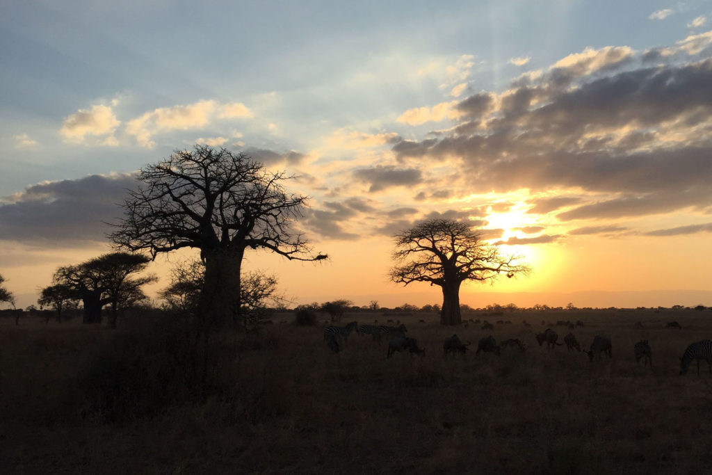
Tarangire National Park is a protected natural area in northern Tanzania. It is located a hundred kilometers west of Arusha, on the road leading to Dodoma, southeast of Lake Manyara. It’s named after the Tarangire River, which runs through it. Compared to parks such as the Serengeti, the landscape is greener; around the river there are extensive swamps and floodplains, but also forests. Especially during the dry season, the park is home to numerous animals: zebras, gnus, alcelafi, minor kudu, dik-dik, numerous species of gazelles, buffaloes, giraffes, elephants, felines such as cheetahs and lions. One of the most characteristic tree species is the umbrella acacia (Acacia tortilis). It is the Tanzanian park with the highest concentration of baobabs.
KILIMANJARO
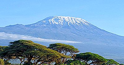
Kilimanjaro or Chilimanjaro (in English and Swahili Kilimanjaro), with its three volcanic cones Kibo, Mawenzi and Shira, is a dormant stratovolcano located in northeastern Tanzania. At 5895 meters above sea level. is the highest mountain on the African continent, the highest single mountain in the world and one of the highest volcanoes on the planet as well as being one of the Seven peaks on the planet. It is a stratovolcano formed by three craters: the oldest, Shira, to the west, with an altitude of 3962 meters, Mawenzi to the east, with an altitude of 5149 meters and, among the first two, Kibo, which is the most recent and still shows signs of activity, in the form of fumaroles. Between Kibo and Mawenzi lies a platform of about 3600 hectares, called “the saddle of the winds” which is the largest tundra high ground area in Africa. In 2003, scientists found that a certain amount of magma is only 400 meters below the crater: it is therefore feared that the volcano may collapse (or explode) as did Mount St. Helena (United States) in 1980. Although there is no precise information about when the last eruption occurred, some local legends suggest that there was one about 170 years ago. The summit of the volcano is covered by a perennial glacier (the Rebmann Glacier). Its peaks, together with those of the Meru Mountains, had been named by the Greco-Roman merchant Diogenes Moon Mountains. Diogenes sighted them during the Roman Expedition to the sources of the Nile, around 100 AD. C. It is not known where the name Kilimanjaro comes from, but there are several theories. European explorers adopted this name in 1860, stating that this was the name of the mountain in the Swahili language, assuming that Kilimanjaro could be broken down into Kilima (Swahili for “hill” small mountain) and Njaro which, for some theories, is an ancient Swahili word for white or shining, while for others it is a word of non-Swahili origin; for example in the Kichagga language the word jaro means “caravan”. The problem with all these theories is that they are unable to explain why the diminutive kilima is used, instead of the most appropriate word for mountain, i. e. mlima. A different approach assumes that Kilimanjaro derives from Kichagga kilemanjaare or kilemajyaro which means “defeating bird/leopard/caravan”. However, this theory cannot explain why the name Kilimanjaro was not in use in Kichagga before European explorations in the mid-nineteenth century. In 1880 the mountain, called Kilimandscharo in German, became a part of German East Africa after Karl Peters persuaded the local leaders to sign the treaties. The widespread story that Queen Victoria gave the mountain to William II of Germany is false. In 1889 the Uhuru Peak on Kibo was named Kaiser-Wilhelm-Spitze, a name used in the German Empire until its defeat in 1918, when the territories became part of Tanganyika, ruled by the British, and the name was abandoned.
